 English
 Español
 Deutsch
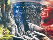
I viaggi di frodo. Le mappe de Il signore degli anelli
Blurb
Journeys of Frodo: An Atlas of J. R. R. Tolkien's The Lord of the Rings by Barbara Strachey is an atlas based on the fictional realm of Middle-earth, which traces the journeys undertaken by the characters in Tolkien's epic.The book comprises 51 two-colour maps at various scales, all based on the original The Lord of the Rings maps drawn by Christopher Tolkien from his father's sketches. Each map is on a right-hand page in landscape format and depicts physical features in black and contour lines in red. Routes taken by characters on roads and paths are shown in dashed black and red; routes off-road are in red only. Arrows show the direction of travel and dates are listed in red. Scales along the top and left of each map show the distance east/west and north/south from Bag End. At the bottom of each map is a scale showing miles to the inch and an indication of the lunar phase or phases visible at the dates given.
Each numbered map is accompanied by a description on the facing left-hand page, in which Strachey describes the portion of the route indicated, often justifying her topographical decisions with quotes from the book.
Member Reviews Write your own review
Be the first person to review
Log in to comment