 English
 Español
 Deutsch
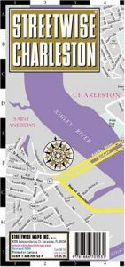
Streetwise Charleston Map - Laminated City Street Map of Charleston, South Carolina
Blurb
Streetwise California Map - Laminated State Road Map of California - Folding pocket size travel mapThis map covers the following areas:
Main California Map 1:2,400,000
Los Angeles Freeway System Map 1:400,000
LAX Access Map 1: 88,000
San Francisco Area Map 1:640,000
San Diego Area Map 1:160,000
Sacramento Area Map 1:200,000
California is a state of being as well as a destination state. From Imperial Beach, San Diego north to Pelican State beach near Oregon, the STREETWISE® map of California lays out all the major state and county roads, freeways, cities, towns and major sites on one map.
On the back of the California state map you ll find enlarged inset maps of Los Angeles, San Diego, San Francisco, and Sacramento revealing more detailed driving information. In addition to city inset maps, also included is a detailed access map for Los Angeles International airport including the specific locations of car rental companies. Another small inset with driving distances and travel times was created to aid trip planning.
All in all this is one heck of a map to have for visiting the premier destination state of California. Even for natives this California map is a more convenient alternative to the multipage atlas that most people carry in their cars.
Our pocket size map of California is laminated for durability and accordion folding for effortless use. The STREETWISE® California map is one of several detailed and easy-to-read state road maps designed and published by STREETWISE®. Buy your STREETWISE® California map today and you too can navigate California like a native. For a larger selection of our detailed travel maps simply type STREETWISE MAPS into the Amazon search bar.


Member Reviews Write your own review
Be the first person to review
Log in to comment